It is difficult to imagine how much a landscape can be transformed by an eruption, rendering large swaths of land unrecognisable to locals who knew it well. It is the task of volcanologists to understand the impacts before it happens.
This time 44 years ago, Mount St Helens in Washington State had just unleashed a devastating eruption on May 18, 1980.

Janine Krippner
Fifty seven people had lost their lives. Families and friends were reeling from the shocking loss. Volcanologists were grieving the loss of their colleague David Johnston while having to continue working on understanding what had just happened and what might happen next. Would there be more powerful eruptions?
The cataclysmic eruption had begun with a large flank collapse. The upper 400 m of the volcano now lays broken across the landscape, depositing 2.5 km3 of fragmented rock out to 23 km as a debris avalanche deposit. This was overtaken by a catastrophic sideways blast (pyroclastic flow) of hot rock and gas that raced across the landscape at speeds of at least 430 km per hour, toppling mature trees like they were twigs in sand. The peak speed of an F1 race car is about 375 km per hour.
Around 2.3 billion cubic meters (405 million tons) of rock had just come to rest in the North Fork Toutle River valley. Additionally, the mountain ice within these hot deposits was rapidly melting. More issues were on their way. Volcanic material + a lot of water = lahars. Those lahars would destroy over 200 homes and more than 300 km of roads.

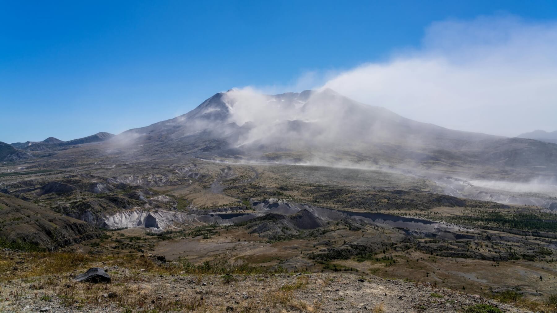
Fog on Mount St Helens. Photo: John Callery, pexels.com
The debris avalanche had crashed into the nearby spirit lake, raising its resting elevation by 64 m and forming a dam. A dam built of broken rock fragments that could release disastrous amounts of water if action wasn’t taken. Scientists rushed to calculate how long the dam might hold, what the impacts would be to populated areas downstream with the increased flood risk, and how to prevent that from happening. A tunnel would eventually be excavated to manage this risk, and this will be maintained well into the future.
Once an eruption ends, the recovery can take decades. The more that people are prepared, the faster and more effective this process can be. The United Nations Office for Disaster Risk Reduction says that “every US$1 invested in making infrastructure disaster-resilient saves US$4 in reconstruction”. We know that understanding impacts then investing in preparedness benefits us. Part of my work is understanding how eruptions impact society, including our homes and infrastructure, so that we can learn from the experiences of others and be more prepared to act when it’s our turn. And our turn will come.
The altered landscape can continue to adjust and produce new dangers for decades after a volcano stops erupting. This is a natural process for our beautiful, active planet. Understanding these processes means we can empower ourselves by taking action to reduce our risk and be out of the way while our land does what it does, then work together to pick up the pieces.

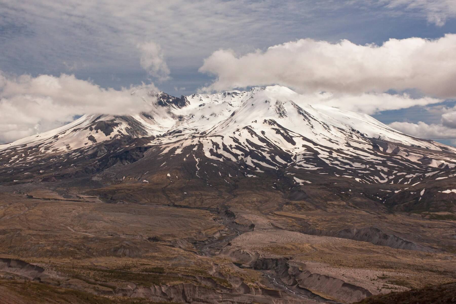
Mount St Helens. Photo: Michael McGarry, pexels.com


